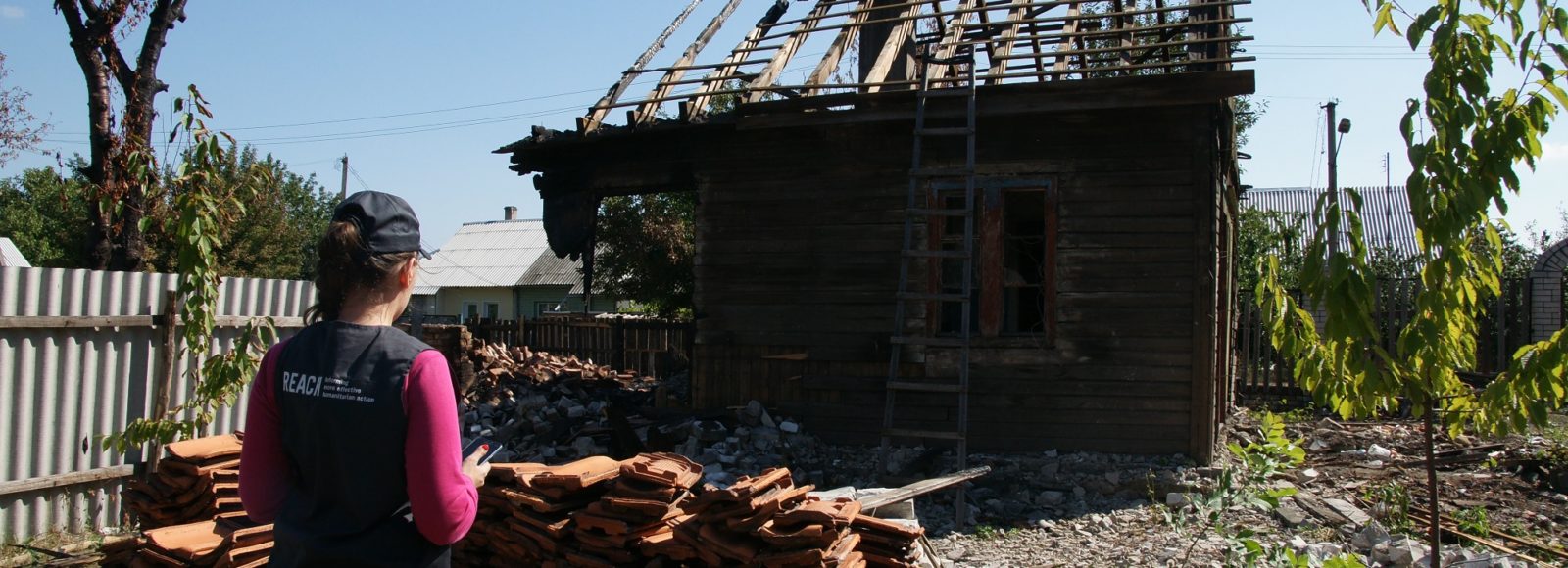

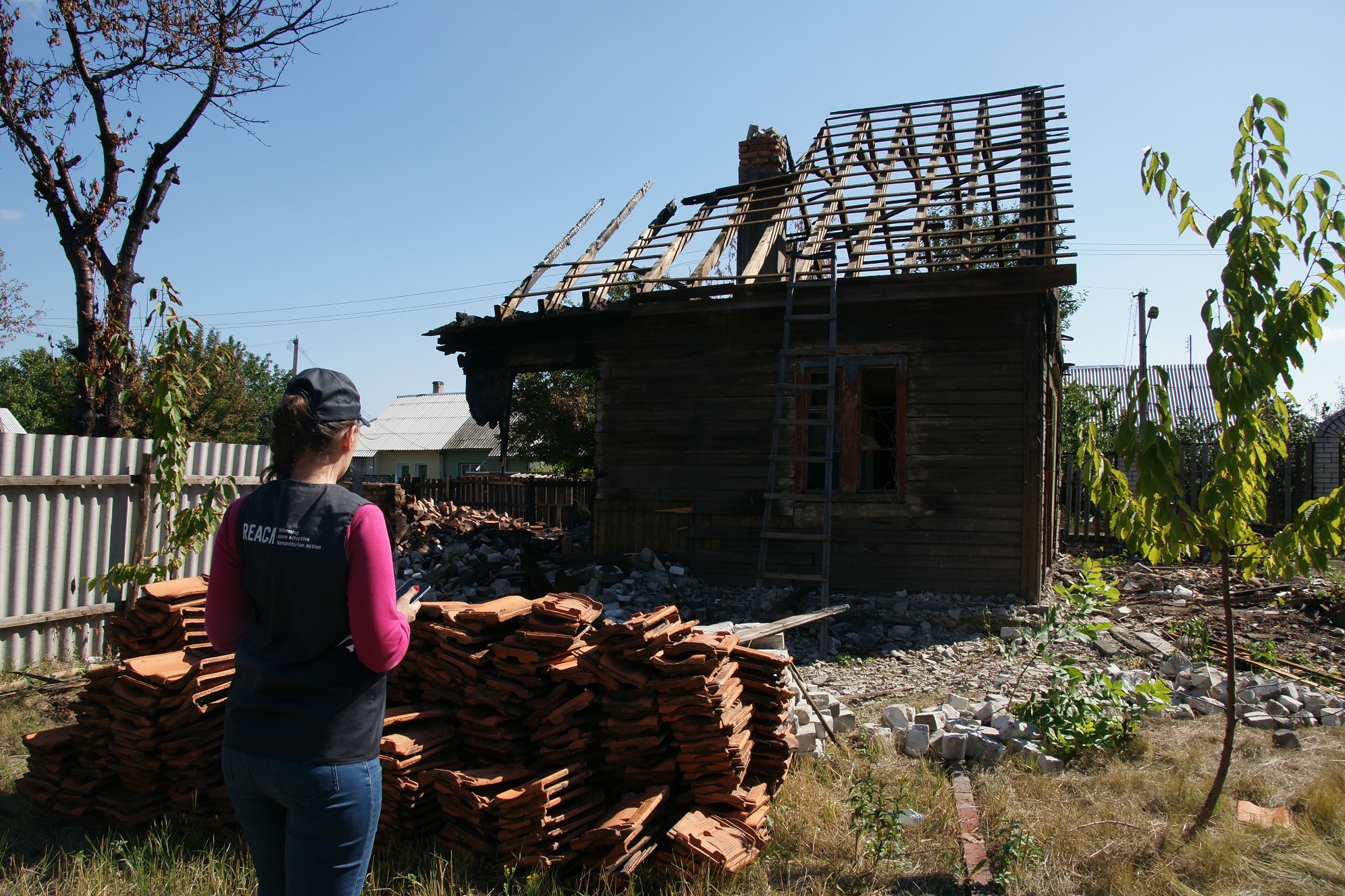
REACH visits a house near the line of contact that was destroyed in August 2017 following a shelling incident in densely populated areas near Zolote. The local resident was relocated in a nearby building which was also damaged due to fighting between the Ukraine army and separatist forces. © REACH/September 2017
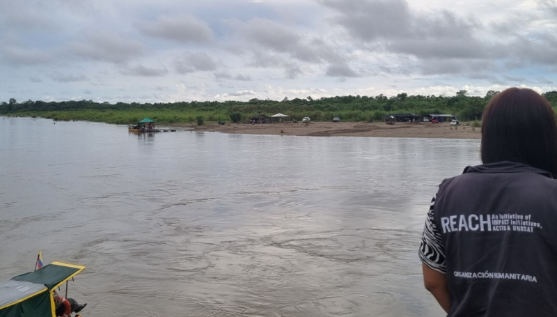
After three years of conflict between Ukrainian forces and armed opposition groups in eastern Ukraine, almost 10,000 people have been killed, 22,231 wounded, and about one million displaced from their homes. Clashes on the contact line between Ukrainian forces and armed groups take place daily, and people living in the area closest to the contact line are struggling to access basic services such as healthcare and education, banks, and markets.
A detailed understanding of the key challenges residents face in accessing services is crucial for local authorities, UN Agencies and NGOs to address immediate humanitarian needs and support ongoing recovery efforts. To provide this information, REACH conducted an area-based assessment between May and June 2017 across 100 settlements in government-controlled areas within 5 km from the line of contact between Ukrainian armed forces and separatist groups. The assessment was designed in partnership with 14 agencies, and implemented with the support of the Office of U.S. Foreign Disaster Assistance (OFDA). Data was collected through interviews with 350 Key informants representing health facilities, education facilities, local administrators and community residents. Using data on where residents access health, education, financial, and market services, REACH conducted a network analysis and grouped the communities assessed into seven Basic Service Units (BSUs).
Across the seven BSUs, the assessment identified the key challenges as a lack of services and facilities, forcing residents to travel long distances to reach schools, banks and healthcare. In smaller communities there are very few education or health facilities available, while in larger communities many facilities have been damaged by shelling. Shelling and landmines make travelling dangerous, while insufficient public transport and military checkpoints mean that travelling is expensive and time-consuming. Within communities, waste management services have been disrupted by conflict and burning or dumping waste are very common. Key informants from health and education facilities reported their facilities have insufficient supplies, equipment and qualified staff. Many of the smaller facilities are not connected to water or sewage networks and lack vital medication such as insulin and antibiotics.
Using the data collected, REACH is also producing an interactive webmap, which will be used by local administrators and UN/NGOs to determine needs and vulnerabilities in the communities assessed. In the second stage of this project, REACH will provide training and information management capacity development for local administrators so that they can update the webmap, ensuring that up to date data is always available for Ukrainian authorities and the humanitarian community.
The overview of the assessment findings can be accessed here.
Individual profiles of the seven Basic Service Units are available at the following links:
- Avdiivka: http://bit.ly/2iEvgru
- Bakhmut: http://bit.ly/2hgDoKY
- East Luhansk: http://bit.ly/2lm2UmI
- Popasna: http://bit.ly/2yQBWZW
- Toretsk: http://bit.ly/2zctpRN
- South Donetsk: http://bit.ly/2iF2o22
- West Donetsk Network: http://bit.ly/2yRKm0R