


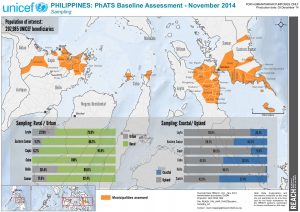
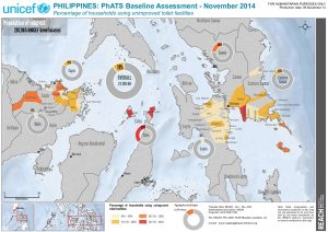
PHL_Map_PhASTBaseline_Sampling_A4
PDF2.8M
IMPACT was deployed to the Philippines through its initiative REACH following four separate disasters starting in 2012. The first deployment followed the tropical storm Sendong, the second typhoon Bopha, the third Bohol earthquake and the fourth typhoon Haiyan. Each deployment was conducted in support of cluster response planning, coordination and monitoring, including with the Shelter Cluster, the Camp Coordination and Camp Management Cluster, and the WASH Cluster.
By 2050 over 70% of the global population will live in urban areas.
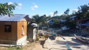
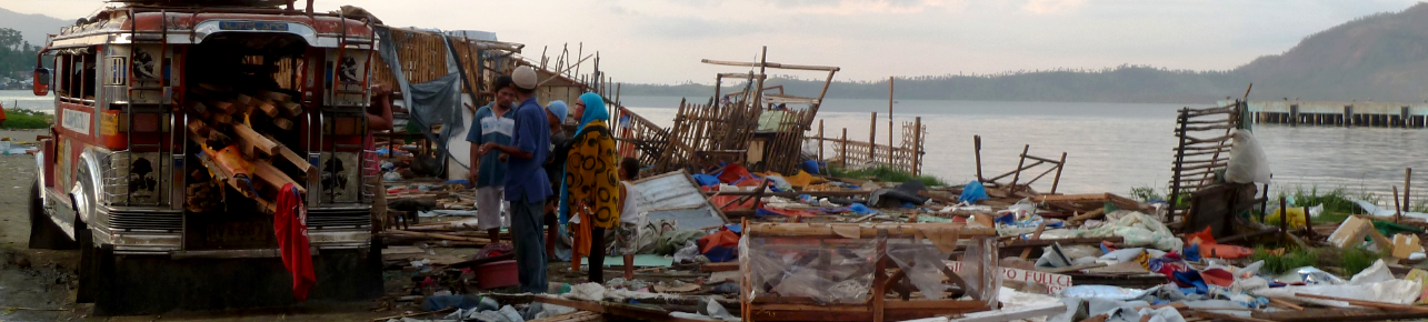
When Typhoon Haiyan, locally known as Yolanda, reached the Eastern Visayas region of the Philippines on 8 November 2013, it was the strongest typhoon ever recorded to make landfall and...
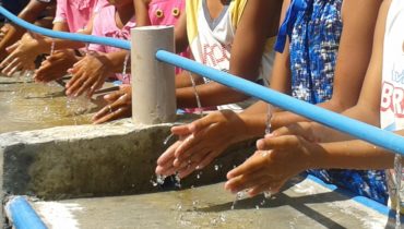
One year after Typhoon Haiyan and as the situation has stabilised, REACH conducted a large-scale study to contribute to the development of best practices for sustainable change in sanitation and...
PHL_Map_PhASTBaseline_Sampling_A4
PDF2.8M
PHL_Map_PhASTBaseline_sanitation_A4
PDF1.7M
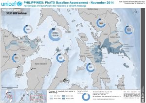
PHL_Map_PhASTBaseline_WashMessage_A4
PDF1.7M
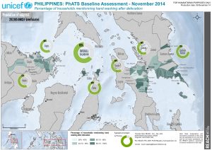
REACH_PHL_MAP_PhASTBaseline_handwashdefec_A4
PDF13.1M
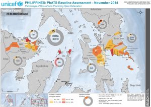
REACH_PHL_MAP_PhASTBaseline_OpenDefecation_A4
PDF13.1M
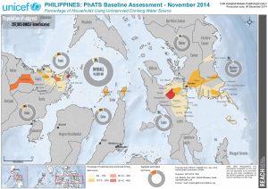
REACH_PHL_MAP_PhASTBaseline_DrinkingWater_A4
PDF13.1M

REACH_PHL_MAP_PhASTBaseline_sanitation_A4
PDF13.0M

REACH_PHL_MAP_PhASTBaseline_WashMessage_A4
PDF13.0M
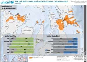
REACH_PHL_MAP_PhASTBaseline_Sampling_A4
PDF28.6M
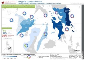
PHL_Map_HaiyanTyphoon_ShelterClusterAssessmentAdequacyLevels_Sep2014
PDF392.8K
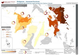
PHL_Map_HaiyanTyphoon_ShelterClusterAssessmentDamageLevels_Sep2014
PDF392.8K
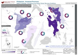
PHL_Map_HaiyanTyphoon_ShelterClusterAssessmentSafetyLevels_Sep2014
PDF1.5M
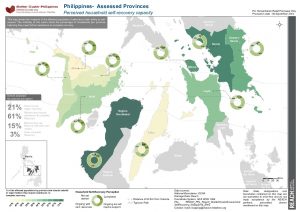
PHL_Map_HaiyanTyphoon_ShelterClusterAssessmentSelfRecovery_Sep2014
PDF401.4K
PHL_Report_Haiyan_ShelterSectorResponseMonitoring2_Sep2014
PDF5.3M
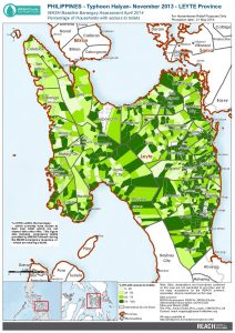
PHL_Haiyan_ProvinceLeyte_WAT_AccessToilet_21MAY2014_A4
PDF1.1M
PHL_Factsheet_TyphoonHaiyanShelterSectorMonitoring_Aug2014
PDF717.5K