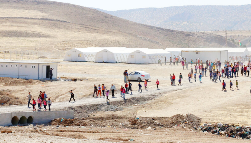


Camps and informal settlements are home to thousands of displaced families in Iraq’s Northern Governorates and the Kurdistan Region, KRI, where around 220,000 Syrian refugees and 1.2 million internally displaced persons (IDPs) currently live. To cope with the large number of arrivals between June and August 2014, many new displacement sites have recently been established and others expanded or re-opened.
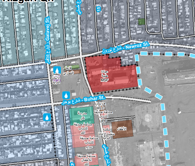
REACH has been producing maps to assist with site planning, camp management, and the analysis of camp conditions, in partnership with the UN Refugee Agency (UNHCR) and the Camp Coordination and Camp Management Cluster (CCCM).
Multiple actors work in Northern Iraq’s displacement sites, including United Nations and Government agencies, National and International non-governmental organizations, as well as numerous community based organisations and local volunteers. The availability of bilingual maps in both English and Arabic means that information is more easily accessible to all those involved, including members of the displaced community.
In order to improve cooperation, coordination and collaboration between all those working in camps, general infrastructure maps are now available in both English and Arabic for over 30 camps and informal settlements in the Northern Iraq.
All camp maps for Iraq are available on the REACH Resource Centre