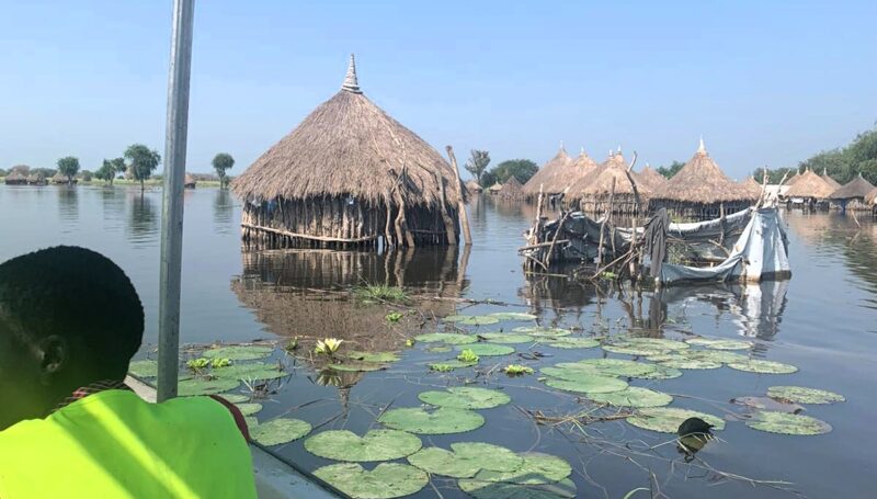

Sudan faces recurring floods that severely impact local communities, especially in vulnerable regions such as North Darfur, West Darfur, Sennar, Blue Nile, and Khartoum. To support humanitarian efforts, IMPACT Initiatives, via its REACH Initiative has developed flood susceptibility maps using advanced multi-criteria analysis. These maps highlight high-risk areas, helping humanitarian actors prioritize interventions, better allocate resources, and strengthen flood resilience.
By identifying areas with the greatest susceptibility to flooding, these maps enable targeted response efforts to minimize the impact on displacement, infrastructure, and livelihoods.
These maps are crucial for improving preparedness and mitigating the effects of floods across Sudan’s most affected regions. For more details and to explore the full suite of resources, visit the Resource Centre.