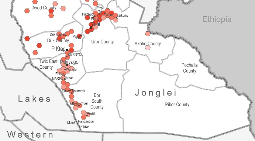
Food security levels in Jonglei State in April and May 2017 are the lowest recorded by REACH to date, particularly for Duk and Ayod counties
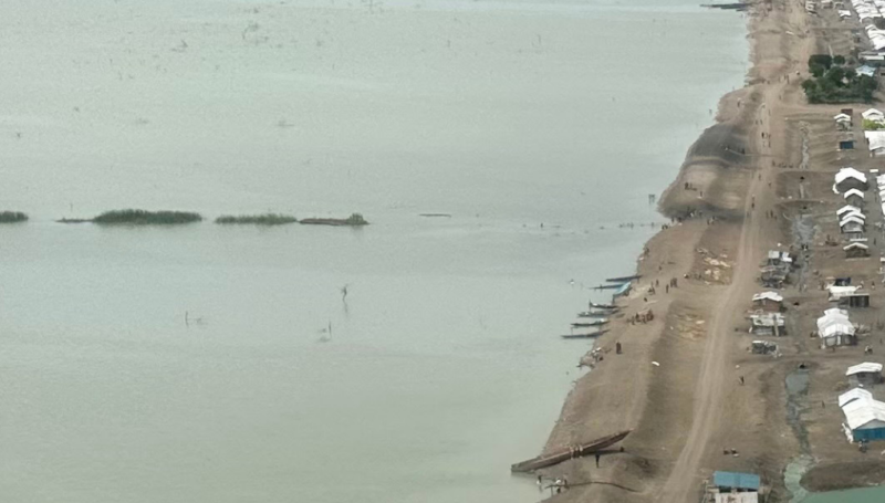
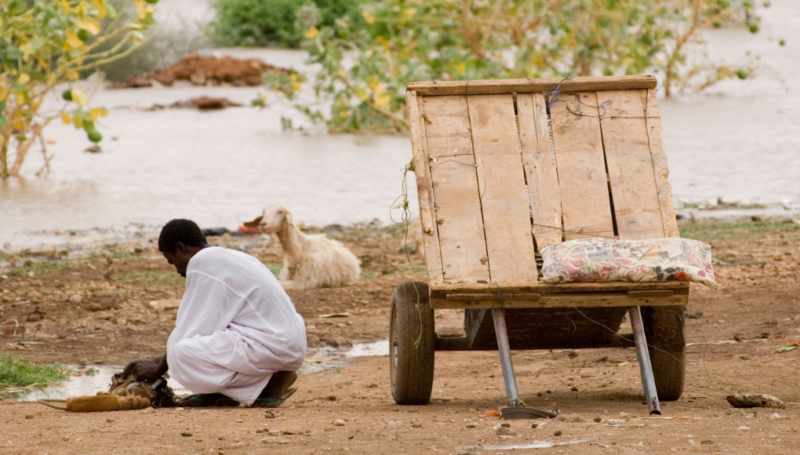
Three months after the declaration of famine in Unity State, South Sudan, despite improvements most likely resulting from of a rapid up-scale of humanitarian assistance in Central Unity, the humanitarian situation has continued to worsen across the rest of the country. Aid agencies are struggling to overcome a host of challenges including limited access, logistical constrains and insecurity to address a widespread food emergency in the world’s youngest nation. As of June 2017, an estimated 45,000 South Sudanese are still facing famine conditions and 1.7 million are experiencing emergency levels of food insecurity, according to the Integrated Food Security Phase Classification (IPC).
In response to this growing food emergency, REACH has been conducting monthly assessments of hard-to-reach areas using its Area of Knowledge (AoK) methodology to address information gaps and improve humanitarian planning in the worst affected areas of the country. Further to this, REACH conducted four rapid Food Security and Livelihoods (FSL) assessments at the household level in Rubkona, Guit, Duk, and Akobo using tools compatible with the Integrated Acute Food Security Phase Classification (IPC) framework, to support the classification of counties at risk of severe food insecurity. The aim of these assessments was to identify if these four counties are at risk of either crisis (phase 3) or emergency (phase 4) levels of food insecurity. In addition, REACH is currently conducting a rapid assessment in Ayod county which has been classified as phase 4 (emergency) with 20,000 of the population estimated in phase 5 (humanitarian catastrophe), to assess the extent of severe food insecurity.
As a result of an escalation of armed clashes as well as the progression of the lean season, access to adequate amounts of food was only 31% in settlements assessed in Jonglei State in April and May 2017, according to REACH Area of Knowledge data. This represents the lowest value recorded by REACH to date and is indicative of declining food access levels in Jonglei since January 2017. In particular, REACH data has consistently identified Duk and Ayod counties in Jonglei State as experiencing very low levels of access to food, with only 10% of assessed settlements reporting sufficient access to food in Duk in April and only 17% reporting sufficient access to food in Ayod in May. The rapid assessment conducted by REACH in Duk county reflected these concerning trends and found that, overall, 82% of households assessed in Duk had poor food consumption scores. Upon receiving these findings, the humanitarian response has scaled up assistance in Duk and, as of May, there has been a slight improvement from 10% to 28% assessed settlements accessing food in May.
To feed information from REACH Area of Knowledge data and rapid Food Security and Livelihoods assessments into the Integrated Food Security Phase Classification (IPC) update, REACH participated in the IPC workshop conducted in May 2017 in Juba, and shared reports, factsheets, and data to support the food security classification of counties across South Sudan. In parallel, REACH continues monitoring hard-to-reach and worst-affected areas in South Sudan and will release soon the results from the ongoing rapid assessment in Ayod county, Jonglei State.
For more information on the status of food security and livelihoods in South Sudan, REACH has been producing monthly factsheets, situation overviews, and maps on Jonglei State, Unity State, Upper Nile State, Western Bahr el Ghazal and the Greater Equatorias. Access detailed findings below.
Factsheets
Info-graphic summarizing key multi-sector needs in hard-to-reach areas:
- Jonglei State: http://bit.ly/2sCKRLg
- Unity State: http://bit.ly/2rulPym
- Upper Nile State: http://bit.ly/2svnzHy
- Western Barh el Ghazal: http://bit.ly/2rtVMY2
- Greater Equatoria: http://bit.ly/2t55tcu
Situation overviews
In-depth analysis of displacement patterns, push and pull factors, and multi-sector needs in hard-to-reach areas:
- Jonglei State: http://bit.ly/2rxBFav
- Unity State: http://bit.ly/2sh0ntm
- Upper Nile State: http://bit.ly/2r8NDUW
Maps
Composite food security maps showing areas that are likely to be food insecure:
- Jonglei State: http://bit.ly/2t57mWM
- Unity State: http://bit.ly/2s467ZB
- Upper Nile State: http://bit.ly/2sCDfIG
- Central Equatoria State: http://bit.ly/2srQtaJ