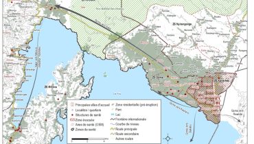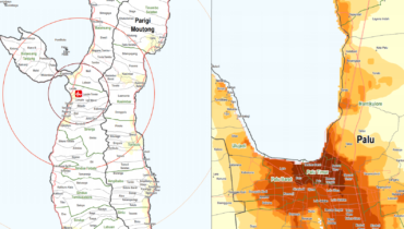
Indonesia: Mapping the impact of a 7.4 MT earthquake and ensuing tsunami through remote sensing
Since the onset of the disaster caused by the tsunami, REACH has supported the Government of Indonesia and the PP Cluster by assessing the scale of the damage through remote sensing. With the aid of satellite images, the collaboration resulted in a series of maps identifying damaged buildings, displacement sites and locations of liquefaction and landslides.