


IDN_TOR_CentralSulawesi_MSNA_Jan2019
PDF944.4K
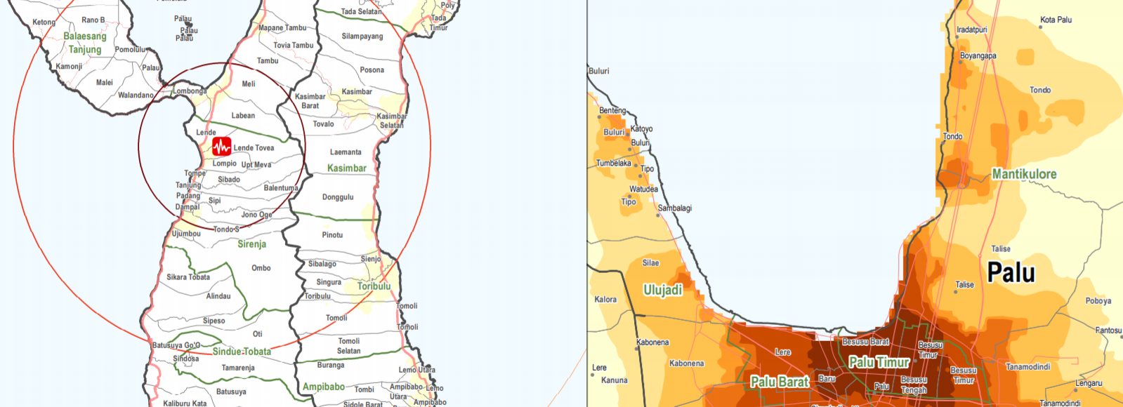
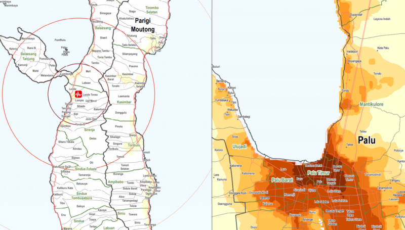
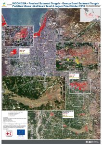
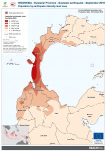
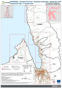
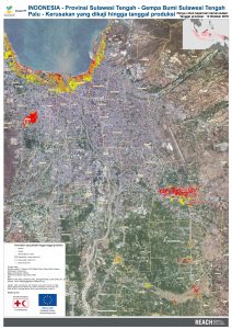
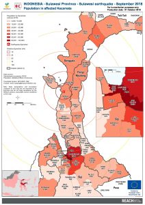
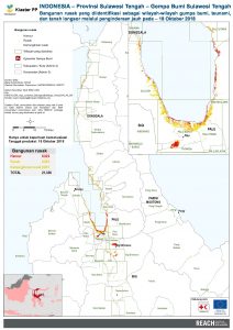
On the 28th of September, a series of earthquakes struck central Sulawesi province, the strongest a 7.4 magnitude earthquake with an epicentre only 10 kilometres deep. The earthquake triggered a tsunami that hit the provincial capital Palu and the coastal city of Donggala with waves up to six meters high. The earthquake, tsunami, aftershocks and resulting liquefaction and landslides caused significant damage, loss of life and challenges for the delivery of aid in the worst affected areas.
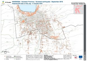
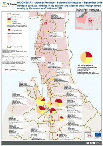
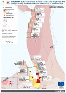
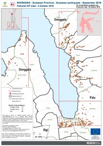
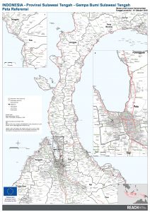
Since the onset of the disaster, IMPACT, through its humanitarian data initiative REACH, supported the Government of Indonesia and the PP Cluster by assessing the scale of the damage through remote sensing. With the aid of satellite images, the collaboration resulted in a series of maps identifying, for example, damaged buildings, displacement sites and locations of liquefaction and landslides. The rapid deployment soon developed to a humanitarian needs and shelter assessment of disaster-affected areas.
Since the onset of the disaster caused by the tsunami, REACH has supported the Government of Indonesia and the PP Cluster by assessing the scale of the damage through remote...
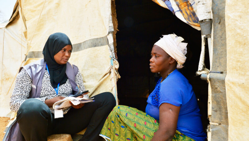
In a system facing growing humanitarian unmet needs and shrinking resources, community participation is frequently cited as a cornerstone of the Humanitarian Reset. Yet in practice, the challenges and priorities expressed by crisis-affected people...
In recent years, Uganda, which hosts one of the largest refugee populations in Africa, has faced increasing exposure to climate hazards, including heavy rains and prolonged dry spells. The unpredictability and variability of these hazards...
IDN_TOR_CentralSulawesi_MSNA_Jan2019
PDF944.4K

REACH_HFI_IDN_Tool_MSNA_Jan2019_BA
XLSX116.3K
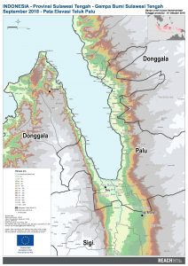
IDN_map_sulawesi_palu_Elevation_02oct2018_A1_BA
PDF3.0M
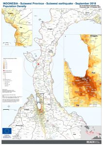
IDN_map_sulawesi_Population_02oct2018_A1
PDF3.6M
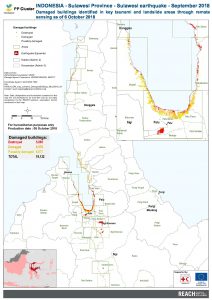
IDN_map_sulawesi_DamagesBuildings_08oct2018_A3
PDF1.0M
IDN_Map_Sulawesi_Palu_Liquefaction_05OCT2018_A1_BA
PDF14.5M
IDN_map_sulawesi_PopulationZone_03oct2018_A3
PDF853.8K
IDN_map_sulawesi_IDPs_18oct2018_A3_EN
PDF1.7M
IDN_Map_Sulawesi_Palu_DamageToDate_12OCT2018_A1_BA
PDF10.3M
IDN_map_sulawesi_PopulationAffectedDistrict_03oct2018_A3
PDF1.2M
IDN_map_sulawesi_IDPsPalu_18oct2018_A3_EN
PDF4.9M
IDN_map_sulawesi_Damages_18ct2018_A3_EN
PDF1.1M
IDN_map_sulawesi_Damages_04oct2018_A3
PDF961.7K
IDN_map_sulawesi_DamagesBuildings_18oct2018_A3_BA
PDF1.1M
IDN_map_sulawesi_IDPs_05oct2018_A3
PDF724.4K
IDN_map_sulawesi_REFERENCE_build_02oct2018_A1_BA
PDF9.7M