REACH mapping tool extended to local governance
11 June 2012
OSH – To support emergency and humanitarian coordination and implementation, IMPACT Initiatives has been developing the REACH mapping tool, since June 2010, in partnership with ACTED and UNOSAT. This program has now been developed into an offline version to be used to support local government actors with their annual budgeting and planning processes.
It is expected that the extension of a mapping tool into local governance will improve accessibility of socioeconomic statistical information and analysis for local communities and improve their planning and prioritization processes. In particular, it is planned that local authorities and civil society members will identify community needs and locally relevant and acceptable solutions to address these socioeconomic issues based on the REACH Offline Mapping Tool.
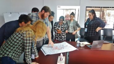
Trainings on the use of the REACH Offline Mapping Tool started in four pilot municipalities of Osh and Jalal-Abad regions have begun. As such, 80 members of local administrations, local councils and Public Advisory Boards will learn how to utilize the offline tool.
REACH is now available in Russian, Kyrgyz and English, and includes over 100 useful socio-economic indicators across over 240 administrative areas. The project is implemented with support of the American people through the U.S. Agency for International Development’s Office of Transition Initiatives (USAID/OTI).


