REACH supports response to displacement crisis in Iraq
23 June 2014
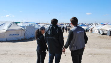
 From the outset of the emergency, REACH has been providing support for the relief response to the current displacement crisis in Iraq through rapid assessments, site mapping, analysis, transit sites and planning for IDP settlements. To upscale its current in-country capacity, REACH mobilized and deployed a team of assessment and GIS specialists. The REACH team is working closely with the Information Management team of the Integrated Coordination Office for Development and Humanitarian Affairs (ICODHA) of the United Nations, and the UN High Commissioner for Refugees (UNHCR), as well as various aid actors engaged in the response to the crisis in Iraq.
The latest factsheets, profiles and reports can be viewed and downloaded below.
The REACH team in Iraq is currently focusing its support on data collection, analysis and mapping for: 1. Entry point monitoring; 2. Camp population profiling; and 3. IDP hotspot assessments. Through this three-pronged approach, REACH aims to contribute to building up as full a picture of possible as to the number, intentions, needs and vulnerabilities of displaced populations.
ENTRY POINT MONITORING
 | ENTRY POINTS Kurdish Region of Iraq Entry Point Monitoring Report 21 – 26 June 2014 |
|---|
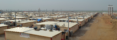
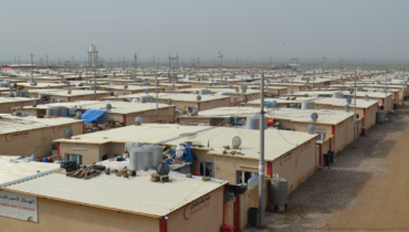
IDP CAMP POPULATION PROFILING
| IDP CAMP PROFILES – IDP Camp Factsheet: Khazir Transit Site 17th June 2014 – IDP Camp Factsheet: Garmawa Transit Site 17th June 2014 |
|---|
IDP ‘HOTSPOT’ PROFILING
 | HOTSPOTS BY GOVERNORATE Duhok Governorate: – IDP Factsheet: Amediyah 30th June 2014 – IDP Factsheet: Semel 29th June 2014 Erbil Governorate: – IDP Factsheet: Bahrka Town 26th June 2014 – IDP Factsheet: Basirma City 26th June 2014 – IDP Factsheet: Kawergosk 29th June 2014 – IDP Factsheet: Shaqlawa Town 23rd June 2014 – IDP Factsheet: Topzawa 29th June 2014 – IDP Factsheet: Zerin Town 26th June 2014 – IDP Factsheet: Erbil Governorate 25th June 2014 Ninewa Governorate: – IDP Factsheet: Al Qosh 26th June 2014 – IDP Factsheet: Bardarash 29th June 2014 – IDP Factsheet: Bartella 30th June 2014 – IDP Factsheet: Zummar 29th June 2014 Sulaymaniyah Governorate: – IDP Factsheet: Kalar Town 23rd June 2014 –IDP Factsheet: Chamchal 29th June 2014 |
|---|
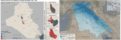
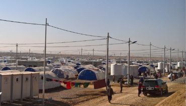
Additionally, REACH GIS unit is supporting ICODHA and UNHCR for the mapping, analysis and planning of displacement sites. Building on modules REACH developed for refugee camps in the Kurdish Region of Iraq (KRI), REACH’s approach to site planning is based on a flexible community block design that allows for an incremental approach to facility provision over time while meeting UNHCR and SPHERE standards. All REACH maps are available at www.humanitarianresponse.info/operations/iraq.
REACH products on the displacement crisis in Iraq will be regularly uploaded on this page. For more information about REACH activities in Iraq, visit our dedicated country page.