
In recent years, Uganda, which hosts one of the largest refugee populations in Africa, has faced increasing exposure to climate hazards, including heavy rains and prolonged dry spells. The unpredictability and variability of these hazards across the country emphasize the need for localized analysis, as they undermine livelihoods, food security, health, and infrastructure, particularly among refugee populations and host communities.
To support informed climate-resilient planning, IMPACT, through its REACH initiative, has conducted Climate Hazard Assessments, providing evidence-based overviews of climate trends and projected impacts in refugee-hosting districts across the Northern/West Nile and Southwestern regions.
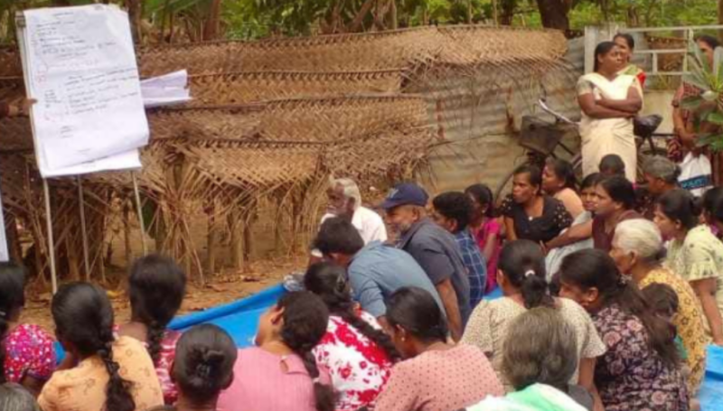
The analyses identify hazard susceptibility, exposure patterns, and future risks to inform the development of targeted interventions and strengthen disaster preparedness among OPM, UNHCR, WFP, district authorities, and humanitarian partners.
Drawing on historical climate data, remote sensing, and projections, the assessments highlight distinct climate patterns between the Northern/West Nile and Southwestern regions. While both regions are projected to become warmer and wetter by mid-century, impacts will differ due to variations in baseline conditions, terrain, and livelihood systems.
Mapping Climate Risk Across Uganda’s Refugee-Hosting Districts
In the Northern/West Nile region, including Yumbe, Koboko, Adjumani, Madi Okollo, Terego, Obongi, and Lamwo districts, average temperatures are projected to rise from about 25°C to 30°C by mid-century, while annual rainfall is expected to increase from 1,138 mm to 1,587 mm. Despite higher rainfall, rising temperatures will accelerate evapotranspiration, leading to greater soil moisture loss and prolonged dry periods during key agricultural seasons.
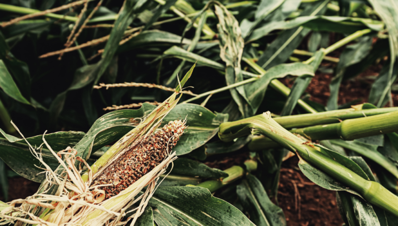
In Southwestern Uganda, across Isingiro, Kamwenge, Kyegegwa, Kiryandongo, and Kikuube regions, average temperatures of about 20.3°C are projected to rise to around 26°C by mid-century, indicating significant warming. Annual rainfall is also expected to increase from about 842 mm to 1,372 mm. However, seasonal drought remains a dominant hazard, leading to vegetation stress, reduced crop yields, and limited pasture and water availability.
According to the Multi-Sectoral Needs Assessment (MSNA) conducted by IMPACT Initiatives in 2024, prolonged dry spells and heavy rains are already the most frequently reported hazards across the West Nile and Southwestern regions, confirming the findings of the analysis.
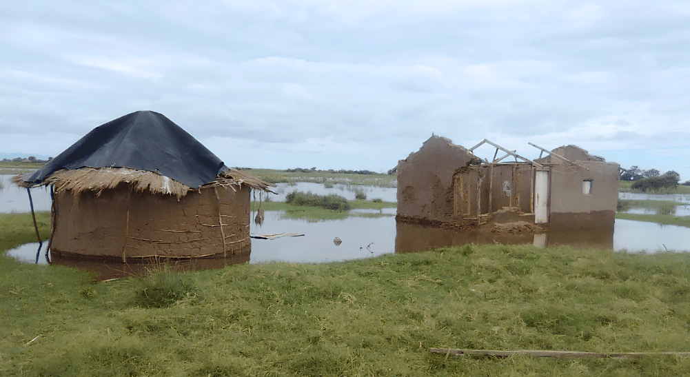
In sub-counties across Adjumani, Obongi, and Terego, seasonal drought reduces soil moisture availability, crop performance, and water access, while recurrent flooding in low-lying areas, driven by proximity to seasonal river channels and poor drainage, results in repeated damage to shelters, farmland, and infrastructure. These pressures are particularly acute in refugee-hosting sub-counties, where land, water, and services are already constrained.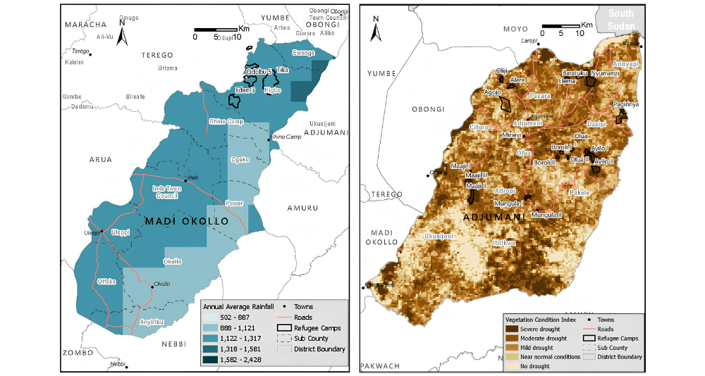
These Climate Hazard Assessments translate national and regional climate trends into local evidence, highlighting key hazards, seasonal risks, and exposure patterns to support targeted planning and resilience for both host and refugee communities.
By providing this localized evidence base, they inform integrated and context-specific adaptation measures, including strengthened early warning systems, climate-resilient agricultural and livestock practices, improved water resource management, and risk-informed land use and settlement planning, ultimately safeguarding livelihoods and enhancing resilience for both refugee and host populations.
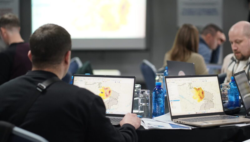
Climate Risk Assessment Methodology
The climate risk assessment in Uganda used a combined geospatial, remote sensing, and climate modelling approach, integrating historical baselines, future projections, and hazard-specific analyses. Historical climate conditions were analysed through spatial and statistical methods. Future projections for 2041–2060 were obtained using the same bioclimatic variables to ensure comparability with historical trends.
Drought analysis followed UN-SPIDER protocols, using the Standardized Precipitation Index (SPI), alongside the Vegetation Condition Index (VCI). Agricultural and rangeland areas were delineated to improve spatial accuracy. Outputs were analysed and visualised in ArcGIS.
Flood mapping was conducted using Sentinel-1 SAR imagery processed in GEE to identify inundation between 2022 and 2024. Annual flood layers were aggregated in ArcGIS to generate flood frequency maps.
Together, these analyses provide an integrated understanding of climate risks affecting both host communities and refugee-hosting areas across Uganda.
Access the Climate Hazard Assessments in the Resource Center and join Uganda newsletter to stay updated on publications from the country.
These analyses were funded by Foreign, Commonwealth and Development Office (FCDO)