


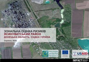
Area Based Risk Assessment in Yasynuvata Raion (Ukrainian)
PDF25.7M

As conflict in Ukraine continues, the gravity of the humanitarian situation is clear. People in areas directly affected by conflict are in immediate need of life-saving support, lacking food, energy, utilities, and facing a breakdown in the provision of basic services. They also face the risk of environmental disasters because of proximity to hazardous infrastructure (such as energy producing facilities and transit infrastructure), a risk that extends well beyond conflict-affected areas. As of 14 March 2022, more than 2.7 million people are estimated to have fled Ukraine and many more are internally displaced, including an estimated one million children. The vast majority of the displaced are women, girls and boys. Some will be staying in neighbouring countries, many more are likely to continue their journey onwards to Western Europe and elsewhere.
You will find the most recent research outputs related to the situation of IDPs in Central and Western Ukraine, to the impact of the conflict on the living conditions in Ukraine, to the refugee humanitarian situation in neighbouring countries and to migration trends from Ukraine here.
Three years into the full-scale invasion of Ukraine, a stark divide in livelihood needs has emerged between rural and urban households. The latest Multi-Sector Needs Assessment (MSNA) story map reveals...
On 24 February 2025, three years into the full-scale invasion, Ukraine continues to face high levels of persistent humanitarian need, and disruptions to essential services linked to ongoing attacks on...

As temperatures drop, millions of Ukrainians are at heightened risk due to ongoing conflict, damaged infrastructure, and severe resource gaps. Ensuring access to heating, cold and hot water, and essential...
Area Based Risk Assessment in Yasynuvata Raion (Ukrainian)
PDF25.7M
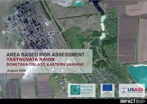
Area Based Risk Assessment in Yasynuvata Raion, Ukraine - August 2020 situation overview
PDF21.0M
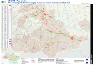
IMPACT UKR WestUkraine FloodedAreas 3July2020 A0
PDF17.2M
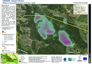
IMPACT UKR map EastUkraine Wildfire 8July2020 A4
PDF3.2M
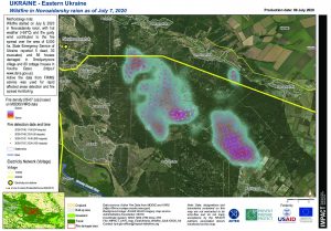
IMPACT UKR map EastUkraine Wildfire 8July2020 A4
PDF3.1M
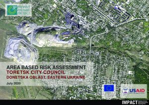
Area Based Risk Assessment in Toretsk, Ukraine July 2020, Situation Overview
PDF25.7M

REACH UKR Data Analysis Plan MSNA GCA July 2020
XLSX167.2K
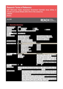
REACH UKR Terms of Reference MSNA GCA July 2020
PDF1.5M
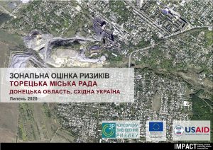
Area Based Risk Assessment in Toretsk City Council (Ukrainian)
PDF14.9M
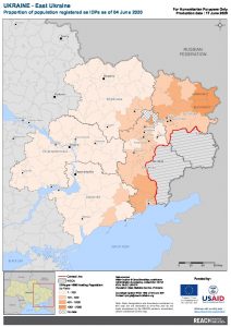
REACH UKR Map EastUkraine ProportionOfRegisteredIDPs 04JUN2020 A4
PDF2.0M
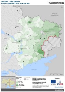
REACH UKR Map EastUkraine NumberOfRegisteredIDPs 04JUN2020 A4
PDF2.0M
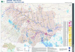
REACH UKR WestUkraine Flood 26June2020 A0
PDF22.4M
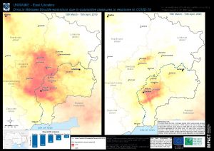
REACH UKR map EastUkraine NO2drop 11MAY2020 A3
PDF31.7M
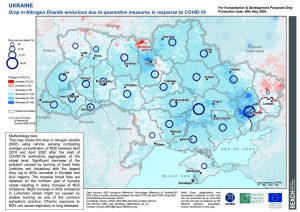
REACH UKR map NO2drop 20MAY2020 A4
PDF3.3M
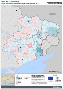
REACH UKR Map EastUkraine ChangeOfRegisteredIDPs 06DEC2019 A4
PDF2.0M
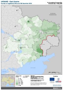
REACH UKR Map EastUkraine NumberOfRegisteredIDPs 06DEC2019 A4
PDF2.0M